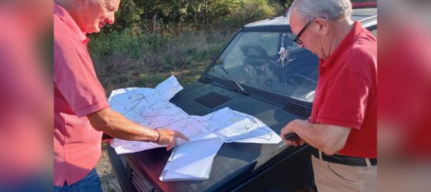
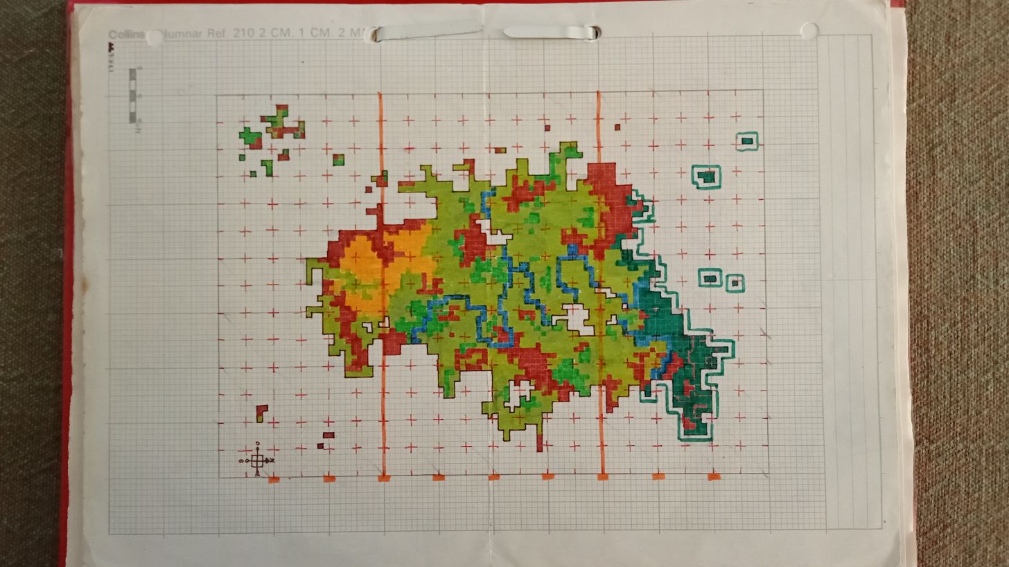
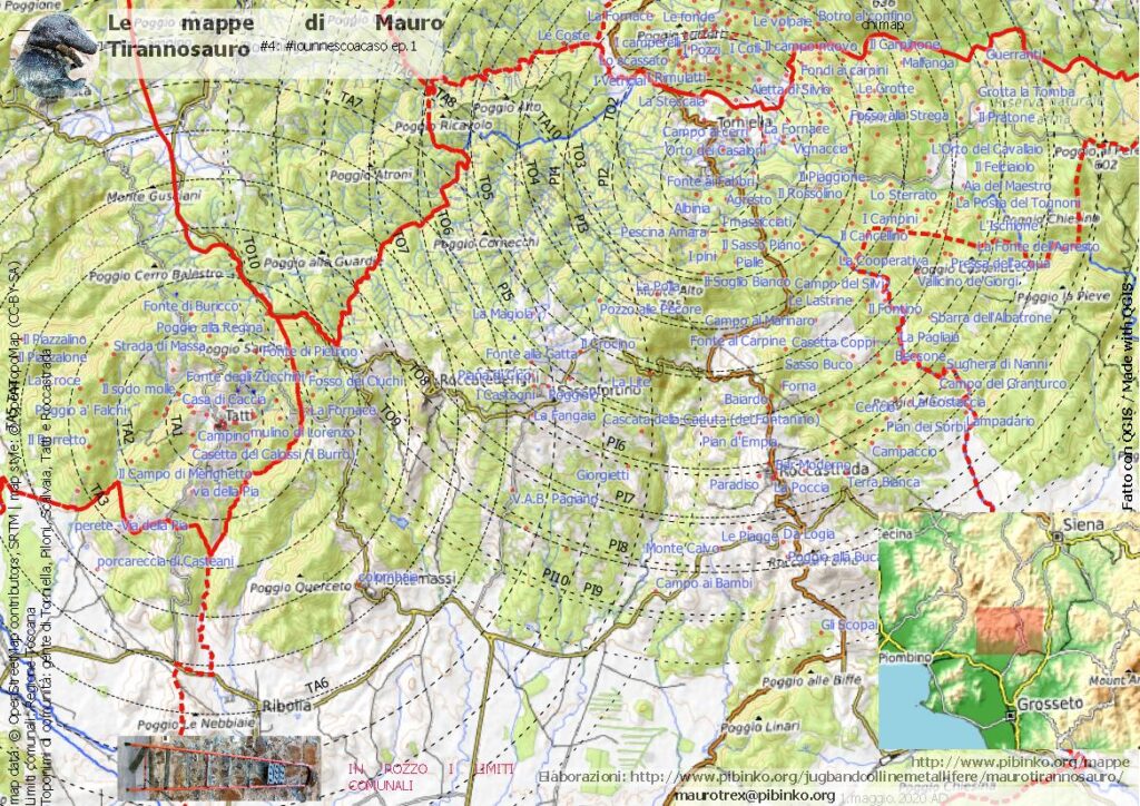
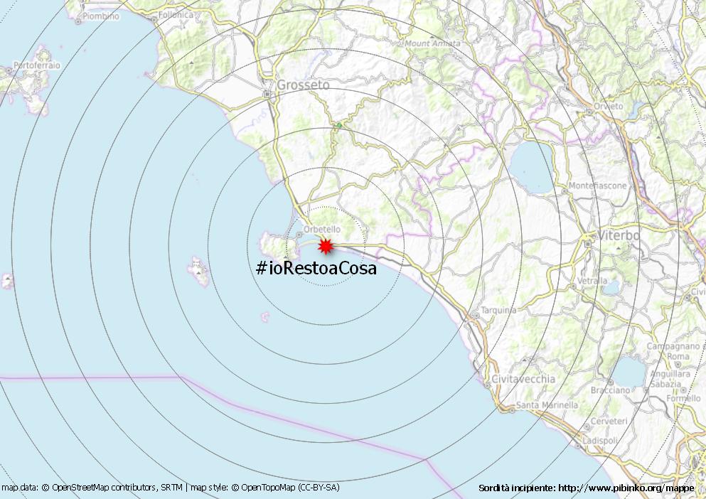
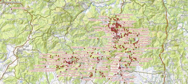
For more information on pibinko-maps: https://www.pibinko.org/maps/

For more information on pibinko-maps: https://www.pibinko.org/maps/
After over twelve years of service, we had to shut down the old page with the map of measurements collected in the project, and maintained thanks Luca Delucchi. We are working on a new version on the map. In the meantime, you may browse this temporary version. For more informazioni bmp@pibinko.org
GRASS is a free/open-source software for the processing of geographic information.
I started to use GRASS for my PhD in 1994 (for my Master’s dissertation in Gent, Belgium, I used IDRISI and an Intergraph MGS workstation). The source code was given to me by Paolo la Barbera from the University of Genova, and I think I have been one of the first ten people in Italt to use this software.
My first setup was on HP-UX. When the Silicon Graphics workstations arrived at the Department, I recompiled GRASS on Irix. Between 1994 and 2002 I used GRASS a lot…I could almost make coffee with it.
To understand the origins of this system, we warmly recommend the 1986 documentary with William Shatner as a narrator. See below.
To be added:
For technical information: the official GRASS web site. For pibinko-style insights and booking: micalosapevo@pibinko.org
June 19 update: please note the Google Meet link to join the event https://meet.google.com/raf-mung-prq, and please pre-register by writing to micalosapevo@pibinko.org
[reccomended soundtrack: Keine Macht für Niemand by Ton Steine Scherben, recently proposed by Jug Band Colline Metallifere in the Lithobag series]
The London Festival of Architecture (LFA) is the world’s largest annual architecture festival. It normally takes place in June. Given the COVID-19 contingency, this year’s edition will be organised with a digital format, to be followed by a public event later in the year. Like many festival, each year has a theme, which for 2020 is Power.
The pibinko.org network was invited to collaborate in the submission of an event for LFA2020. This happened in the context of a collaboration with the Department of Civil Engineering, Architecture, Territory, and Environment at the University of Brescia, Italy (DICATAM). Before this experience, for DICATAM we organised a one-day conference in 2019, and in March and April 2020 Andrea Giacomelli gave lectures on the application of participatory methods for the design of interdisciplinary activities for the protection and promotion of the night sky.
Pleae save the date for June 26, 2020, from 5 to 8PM (Rome Time, UTC+2). The topic we will discuss is the cultural power of the Cold War.
Participation to this event is free, but you need to register by sending an email to micalosapevo@pibinko.org. We will write you back for confirmation and, once you are registered, you will receive with due advance notice the necessary indications to connect on June 26. Your email will be used by pibinko.org only, and only to inform you about the conference connection.
Below is a brief introduction:
The Cold War was the highest expression of the attempt by the USSR and the USA to impose their power on the whole world during the second half of the 20th century.
This clash expressed itself, among other things, in the building a reciprocal fortified line between West and East Europe. In this context, NATO built in Italy numerous architectures and installations to monitor the activity of the Warsaw Pact.
In the first part of the conference, Olivia Longo will present her studies analysing the relationships between the architecture of the Cold War with the Italian architectural theories of the second half of the 1900s. In the second part Davide Sigurtà will describe the Italian North-Eastern military architectures.
In the third part, Andrea Giacomelli will present a participatory mapping exercise will be presented. This will consider test installations and architectures on which citizens worldwide will be invited to provide feedback and impressions. Through various facilitation techniques by the pibinko.org network (including music), the inputs collected from the community in relation to historical aspects, or to the future, of these architectures and installations will be connected to the architects’ view, thus suggesting an avenue to new forms of collaboration between the power of experts and of citizens in this field.
For more information: micalosapevo@pibinko.org
TBT
Grazie alla consulenza di Mauro Tirannosauro, la divisione cartografica di pibinko.org ha prodotto una mappa che riporta delle fasce chilometriche attorno ai borghi, che so tre a caso, Piloni, Tatti, e Torniella. L’ordinanza regionale toscana n. 46 del 29.4 dice:
1.E’ consentito per l’attività motoria svolgere passeggiate all’aria aperta e utilizzare la bicicletta, conpartenza e rientro alla propria abitazione, nell’ambito del comune di residenzain modo individuale,da parte di genitori e figli minori, da parte di accompagnatori di persone non completamenteautosufficienti, o da parte di residenti nella stessa abitazione; 2.nello svolgimento delle attività motorie di cui al punto 1 da parte di genitori e figli minori, daparte di accompagnatori di persone non completamente autosufficienti, o da parte di residenti nella
medesima abitazione non è necessario mantenere le misure di distanziamento sociale di almeno 1,8metri;
Con questa mappa potete prendere le misure rispetto alle vostre capacità motorie, e potremmo magari trovare un punto dove salutarci di passaggio partendo da questi tre punti. Detto questo: la mappa non vuole suggerire alcuna azione specifica. Solo facilitare la lettura di un territorio.
Di peculiare, oltre alla scala e ai confini comunali in rozzo (è Mauro T che cura queste parti), la mappa mostra la toponomastica di comunità raccolta a partire dal 2015, prima in Val di Farma, poi a Tatti, e a a fine febbraio 2020 a Roccastrada, con la Jug Band Colline Metallifere.
Per informazioni e booking: micalosapevo@pibinko.org
In Italian May is “Maggio”, so “Maggeo” is a sort of fusion between the name of the month and the geo- prefix. Since in 2020 it is not possible to attend May Day celebrations in person, in Italy and many other parts of the world, we try to re-enact some past May Day events by simulating their unfolding with a combination of mapping supports, videos and photos.
As a Maggeo prototype we took the 2009 May Day in the Farma Valley, in Tuscany, about 100 km South of Florence. On that occasion, with the BuioMetria Partecipativa project we followed all the celebration. This starts normally at 8.30AM in the Piloni square with a sandwich with marinated anchovies + red wine (or soda if you can’t have wine), and ends around noon at the Torniella football field, after several other stops of this type. At the end of the march, some people possibly end up having too many marinated anchovies, but the spirit of the is May Day is very strong (in all ways).
Along the walk from Piloni to Torniella, we asked to as many people as possible “how dark is the sky above the Farma bridge?” (before posing the question we were giving notions on light pollution and night sky quality measurement, so that our counterpart would not be giving random numbers).
For more information and booking: micalosapevo@pibinko.org
TBT / TBM. To be translated
Mauro Tirannosauro si è unito da poco alla rete pibinko.org e sta suggerendo prospettive inedite per la Fase Bue, su cui si sta documentando. Per esempio, diceva che, anche se ci saranno alcune opzioni in più, sarà importante restare il più possibile a Cosa, e ha lanciato lo hashtag corrispondente. Perplessità sull’uso del camelcase…comunque: si prevede un’escalation di tesi di archeologia nella sessione invernale di lauree di quest’anno. Intanto Mauro T è al lavoro con altre analisi. Estote parati.
Commenti e booking: maurotrex@pibinko.org
About the project: https://www.pibinko.org/participatorylithology/
For more information and booking: micalosapevo@pibinko.org.
Analysing the Regione hydrography databases, we note 59 different types (river, creek, stream etc.). There is an interesting pattern showing in relation to fosso (creek), for which different names are used south of Pisa (botro, in green) and in the Florence/Siena area (borro, in red) . For more details: info@pibinko.org.
In July 2019 we have published some maps with simple walks in the immediate surroundings of Tatti, in the area of Massa Marittima, Southern Tuscany. The walks have been suggested by Auro Luti, a Tatti resident with a deep knowledge of this territory, and are rather short trails (around 5 km).
A peculiarity of these maps is that you will find there also place names which are not part of official cartography. These have been compiled in the past months with interviews and meetings with the Tatti community, as well as the perimeter of the commons (usi civici) related to the village.
The maps are available from Ixtlan Agricamping and Fattoria di Tatti, who sponsored the creation of the maps.
For more information: info@pibinko.org