Category Archives: Maps

Participatory Lithology: the Map

About the project: https://www.pibinko.org/participatorylithology/

  • In the search window below you can type something, and the system will tell you if the project is related to places or people whose names contain what you typed. Even a single character will do.
  • Clicking on the name, or nickname, of a participant, a new window will open with additional information on that person, if available (if not, you will see the main role he/she is covering, either as collector, classifier, entertainer, or sponsor).
  • You too can be part of the project. Check out the roles linked above, and write to introduce yourself.

For more information and booking: micalosapevo@pibinko.org.
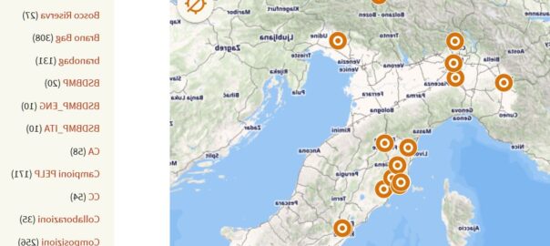
Different ways of calling a creek in Tuscany

Analysing the Regione hydrography databases, we note 59 different types (river, creek, stream etc.). There is an interesting pattern showing in relation to fosso (creek), for which different names are used south of Pisa (botro, in green) and in the Florence/Siena area (borro, in red) . For more details: info@pibinko.org.

Five walks around Tatti, Southern Tuscany

In July 2019 we have published some maps with simple walks in the immediate surroundings of Tatti, in the area of Massa Marittima, Southern Tuscany. The walks have been suggested by Auro Luti, a Tatti resident with a deep knowledge of this territory, and are rather short trails (around 5 km).

A peculiarity of these maps is that you will find there also place names which are not part of official cartography. These have been compiled in the past months with interviews and meetings with the Tatti community, as well as the perimeter of the commons (usi civici) related to the village.

The maps are available from Ixtlan Agricamping and Fattoria di Tatti, who sponsored the creation of the maps.

For more information: info@pibinko.org

The CLIWOC database

As a background this calls for the “Southern Cross” by Crosby, Stills e Nash

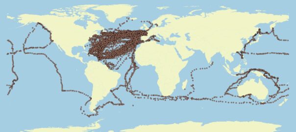
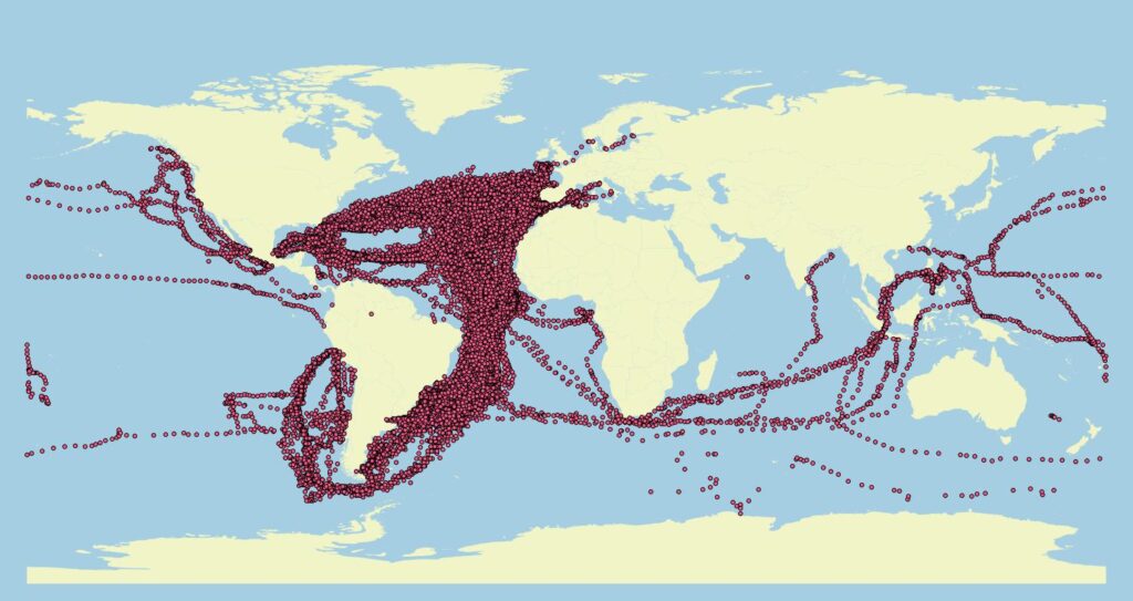
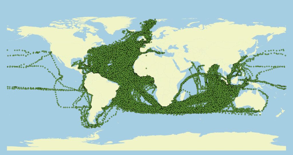
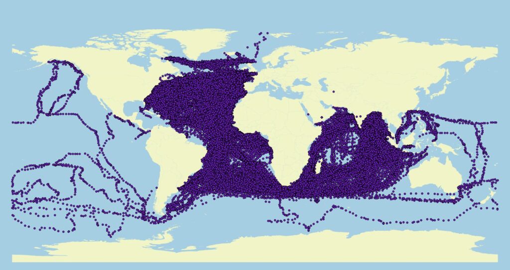
On the line of promoting lesser known resources in the field of culture, environment, and open innovation, I recently recovered the complete database of the CLIWOC (Climatological Database for the World’s Oceans 1750-1850) project. This was a European-funded project between 2000 and 2003 with the aim of digitizing the logs of ships from some European countries over a period of 100 years, so as to extreact weather observations, which needed to be recorded daily. Data are mostly from Spagna, Great Britain and Holland (with some data from France, Sweden, etc.).

Apart from the climatologic aspects, this exercise interested me because of the spatial analysis implications, and having finally accessed the full database, the annotations which can be found.

Here you see some basic visualizations (each dot is one day from a given ship, with additional data attached to it). Geopolitical analysts will be on the loose on this. During the Summer we will show you more of what’s in the CLIWOC trove.

Spagna
Olanda
Inghilterra

It’s in Florence: returning soon (the Farma Valley Community Map)

TO BE TRANSLATED

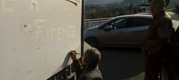
Nell’immagine in evidenza sopra, Mario Straccali, con valido supporto morale, completa la campitura artigianale dello scotch di carta usato per spiegare che se la bacheca su cui da un paio di anni spicca la mappa di comunita’ della Val di Farma (anche citata in un rapporto della Banca Mondiale) e’ vuota, c’e’ un motivo utile.

L’evento di presentazione della mappa, nel 2017, dopo tre anni di aperitivi…pardon…lavoro.

La mappa, con una copia stagionata da dieci mesi di esposizione agli elementi naturali, e’ stata infatti staccata per essere riesposta nel micromuseo della Val di Farma & friends che troverete tra venerdi’ 22 e domenica 24 febbraio presso l’Hotel Lombardi di Firenze (in particolare ci sara’ una visita guidata fra le 18 e le 20 di sabato 24).

Per ulteriori informazioni sulla manifestazione, potete leggere la presentazione dell’evento, scrivere a info@pibinko.org oppure chiamare il 3317539228

All-focus

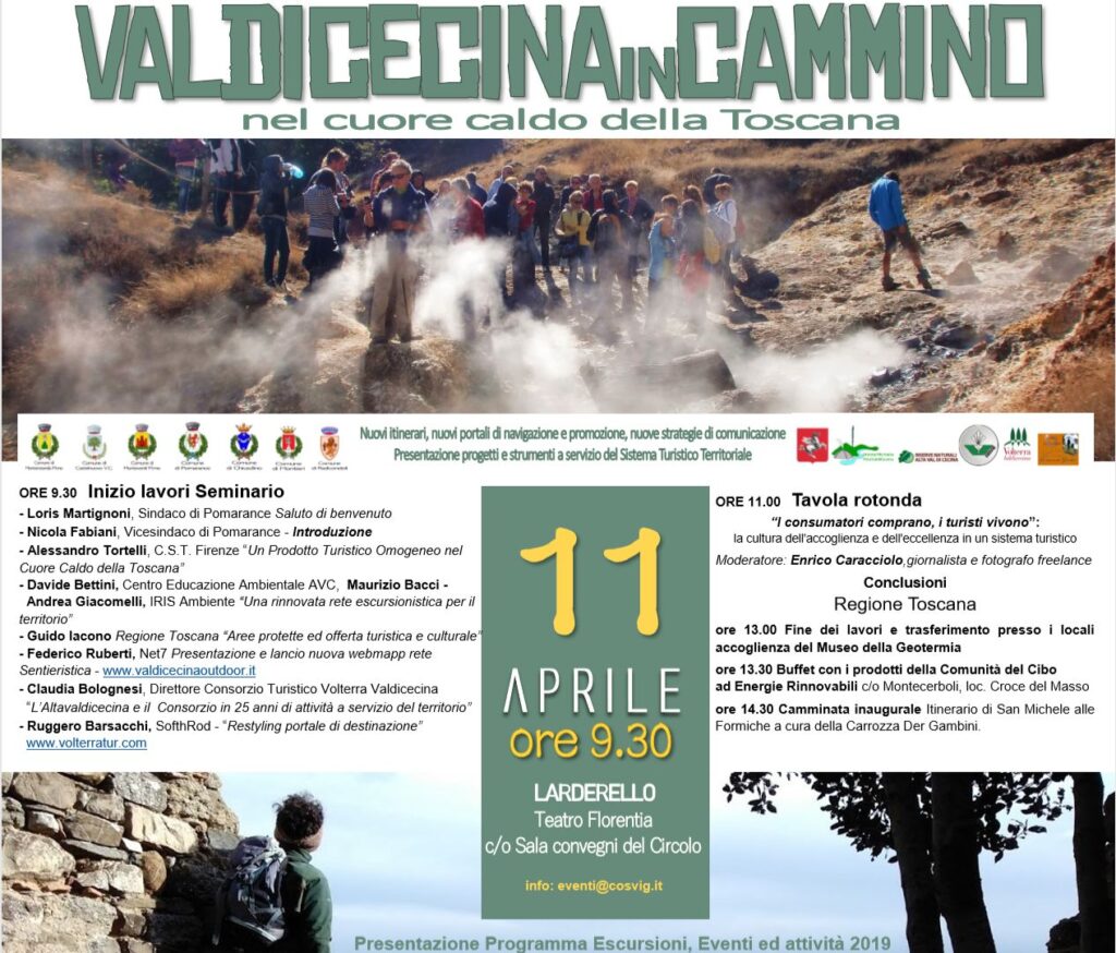
Thu. Apr 11, 2019: Valdicecina trekking in Larderello (Pisa). A conference and a guided tour

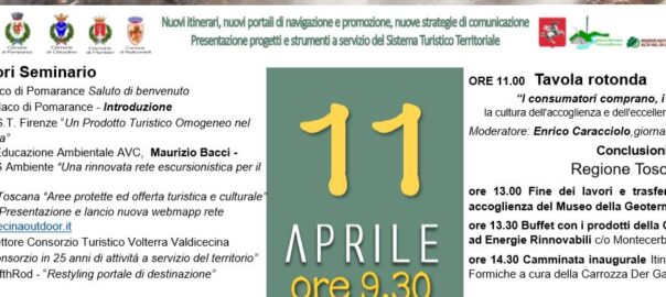
Next Thursday, April 11, pibinko will be part of the speakers at a conference on “New itineraries, new navigation and promotion portals, new communication strategies. A presentation of projects and tools for the local Tourism System”. Here is an excerpt of the flyer.

On this occasion I will give a short talk on the work I have been carrying out in the past two years for IRIS Ambiente and Idealcoop, concerning the new design of the trail system for Unione Comuni Alta Valdicecina. I will also be providing some hints about the peculiarities of the network we have created, collaborating with various experts and local guides.

For more information on this specific activity: info@pibinko.org. For information on the overall event: eventi@cosvig.it

Considering other pibinko.org projects, we might say that we have been partly map(pear)ing the Cecina Valley and its spaces, even though in this phase there has been more mapping, compared to other work we do. Interestingly, in the same period and in the same area, I met various elements that helped me to launch new projects .

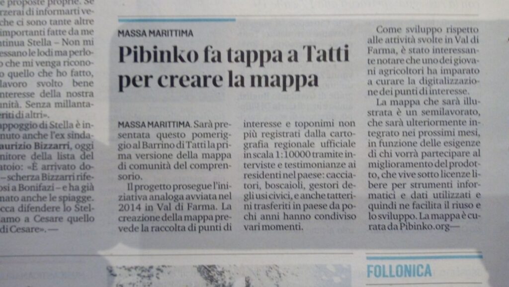
International Open Data Day in Tatti, Tuscany: how did it go?

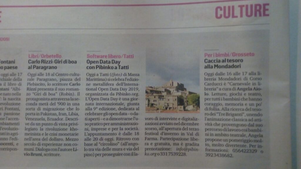
Dopo l’annuncio dell’evento sul sito pibinko.org e il rilancio de Il Tirreno ed. Grosseto, vediamo qualche fase saliente della giornata del 2 marzo 2019 a Tatti, frazione di Massa Marittima (GR), per la nona edizione dello International Open Data Day. Tranne le prime due (di pibinko), le foto sono di Valeria Trumpy dell’Agricampeggio Ixtlan.

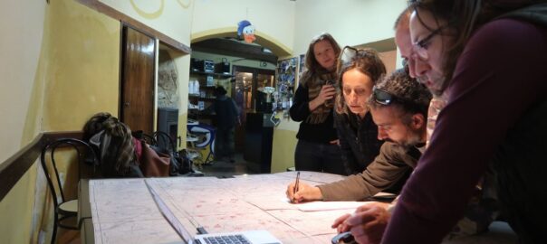
Gabrio Giannini and Auro Luti at work in the “Barrino”…
…with a pool of experts to back them up.

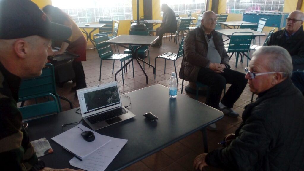
The action then moved over to the “Circolino”…
where Pietro Crivelli gave us some “musipainting”…
Vladimiro Durastanti (Pacha Mama farm) did some honeygraphy
Guido Bendinelli (Ixtlan Agricamping), who also learned to digitze points with QGIS, who did some saffronmatics
The engineers Lombardelli and Giacomelli (we need engineers with names ending in -elli ) played as engineers…
and more or less everybody interacted with each other….

with a reverse angle, parts of the Metalliferous HIlls Jug Band, and a 12-string guitar kindly provided by Oliver Gangemi…and, as a grand finale:
This is a draft version of the points of interest recorded as of March 2, 2019 (not all names are displayed). On the top right, in blue, part of the Farma creek catchment.

Kudos to Sergio Cappelletti, and all those who contributed to the success of this initiative.